
Why Environmental Risk Belongs in Your Pre-Move Research
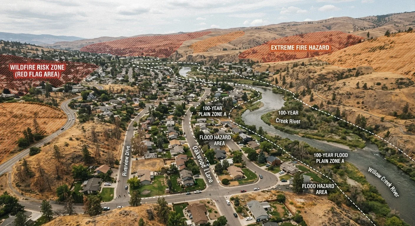
Most homebuyers and renters focus on square footage, school ratings, and commute times - but environmental hazard risk is a long-term livability factor that can affect your finances, safety, and quality of life for as long as you own or occupy the property. A home in a high-risk flood zone may require federally mandated flood insurance that adds hundreds or thousands of dollars per year to your housing costs. A neighborhood in a wildland-urban interface zone may face evacuation orders and rising insurance premiums. These aren't edge cases anymore - they're increasingly mainstream considerations as climate-related risks shift across the country.
This checklist is designed to help you systematically research the environmental hazards that matter most before signing a lease or closing on a purchase. Pair it with the broader neighborhood evaluation checklist to build a complete picture of any community you're considering.
Hazard Maps Have Limits
Official flood and wildfire maps are updated periodically but may not reflect the most current risk conditions, especially as climate patterns shift. A property that sits just outside a mapped high-risk zone is not necessarily low-risk - it may simply not have been remapped yet. Treat official maps as a starting point for research, not a final verdict on safety.
What You'll Need to Get Started
The research below draws on publicly available government databases, official disclosure documents, and state-level hazard maps. You don't need to hire a specialist to complete most of these steps - but for properties with significant identified risk, consulting a licensed inspector, a licensed insurance agent, or an environmental professional is worth considering before you commit.
FEMA Flood Map Service Center
Look up official flood zone designations and Flood Insurance Rate Maps (FIRMs) for any U.S. address.
USGS Earthquake Hazards Program
Access national seismic hazard maps to evaluate earthquake risk at a specific location.
EPA MyEnvironment / ECHO Database
Identify nearby Superfund sites, industrial facilities, and environmental compliance records.
State Fire Agency Hazard Maps
Check wildfire hazard severity zones through your state's official fire or forestry agency portal.
EPA Radon Zone Map
Identify the radon potential level for a county before ordering a property-level test.
CLUE Property Report
Review a property's prior insurance claims history, including weather and natural disaster events.
For renters, note that landlord disclosure requirements vary by state but often include flood zone status and known hazards - request these documents in writing before signing.
Environmental Hazard Checklist
Work through each category below using the official sources listed. Record your findings for each property so you can compare locations and factor risks into your decision.
Flood Risk
Wildfire Risk
Earthquake and Geologic Hazards
Radon and Indoor Air Quality Hazards
Proximity to Industrial and Environmental Contamination Sites
Disclosure Review and Documentation
Disclosure Laws Vary Significantly by State
Some states have robust natural hazard disclosure requirements; others are more limited. Do not assume that the absence of a disclosed hazard means no hazard exists. Always verify independently using the official databases listed in this checklist, regardless of what a seller or landlord provides.
Once you've identified hazards, your next step is understanding coverage gaps. Many standard homeowners policies exclude flood and earthquake damage entirely. See the guide on insurance coverage for natural disasters to understand what separate policies you may need.
Putting the Findings in Context
No location is entirely free of environmental risk. The goal isn't to find a zero-risk property - it's to understand the specific risks attached to a given address and make an informed decision about whether those risks are acceptable, manageable, and priced appropriately into what you're paying.
Environmental risk also shapes the lifestyle trade-offs between property types and regions. If you're weighing coastal and inland options, the coastal vs. inland neighborhood comparison breaks down how these risks translate into real differences in insurance, resilience, and long-term costs. And once you've confirmed a location's hazard profile, don't overlook the practical side: mapping local amenities like healthcare and emergency services matters even more in areas prone to natural events.
This article is for general informational and educational purposes only and does not constitute legal, financial, or insurance advice. Hazard designations, disclosure requirements, and insurance rules vary by state and locality. Consult qualified professionals - including a licensed insurance agent, real estate attorney, or certified inspector - before making decisions based on your specific property or circumstances.